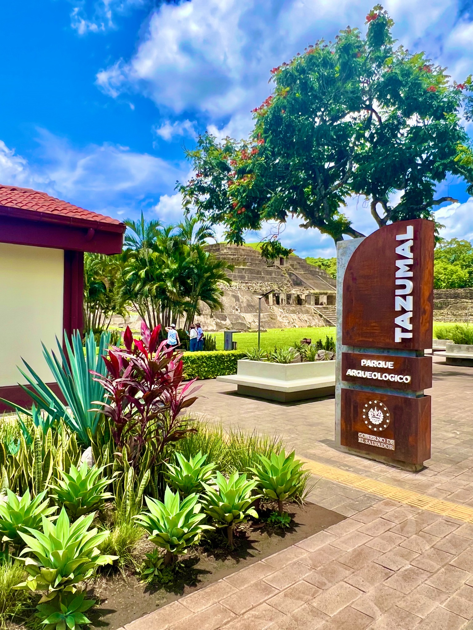
Tazumal
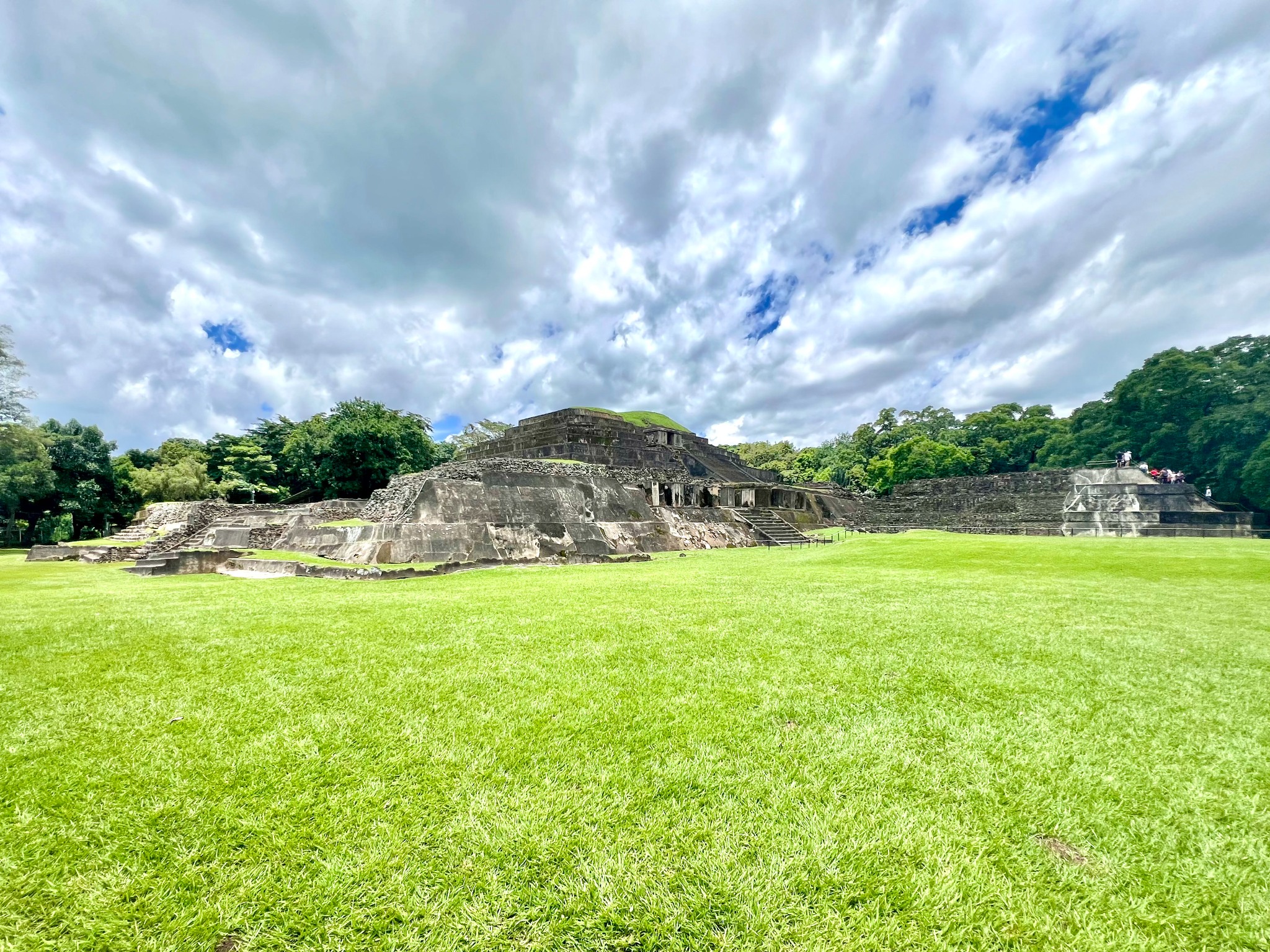
Tazumal is an archaeological site in Chalchuapa, El Salvador with ruins that were initially built over hundreds of years by various peoples from the preclassic, classic, and postclassic periods of Maya civilization. I say "initially built" because the current version that you see when you visit the site is a reconstruction of the site as imagined by an American archaeologist. The ruins are obviously cool to see. The harder part is understanding their relevance. For me, it helped most to first understanding two things: 1) the peoples who contributed to these ruins, and 2) the region where they were built.
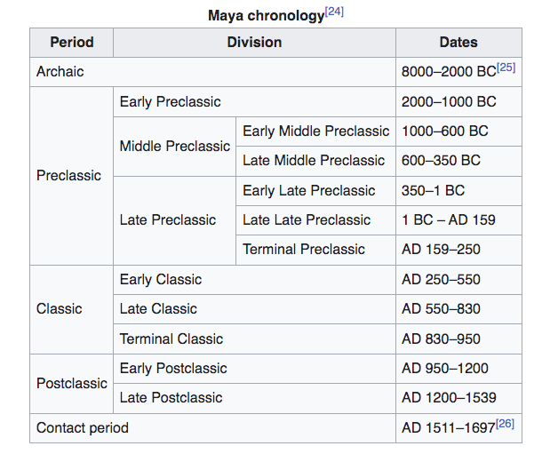
1a) Maya periods
The term "Maya" refers to the indigenous peoples who have occupied Mesoamerica, a region that today would be marked by the southern portion of Mexico plus northern portions of Central America, since history began to be recorded.
History of Maya civilizations have been broken down into several periods. Here is a chart from Wikipedia that explains this:
1b) Maya peoples
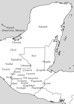
Within each of these periods, there have been numerous cultural groups. We can think of these groups as the dozens of groups of people that have existed over thousands of years that make up what we know as "Maya civilization." These groups, which existed in various areas of the Mesoamerican region, developed cultures that were unique enough in some way to make themselves their own group--Just like regional cultures exist within countries nowadays--but still have enough in common that collectively they make "Maya civilization."
Language is a key component of an ethnic group, so this map from Wikipedia below that shows the distribution of the Mayan language family, although I don't know how comprehensive and relevant it is, helps understand the distribution of these peoples over time.
2) Chalchuapa
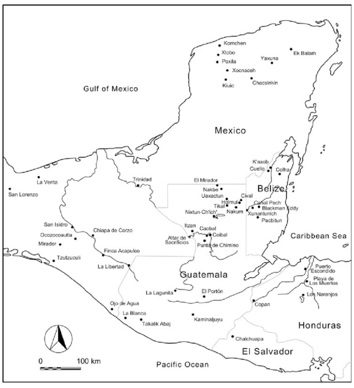
You can also understand better the complexities of Maya civilization over time by looking at a map of regional sites like the one below that I found on ResearchGates.
Just like we can understand culture as regional--New Englander could be a classification of a group of people across several states, or regional designations, who share cultural ties--We can also view a civilization through its regional designations. For example, one portion of Pennsylvania may have more cultural links to the East Coast while another has stronger ties to Appalachia, they both look inward to Harrisburg, the state's political capital for other types of guidance.
Chalchuapa is a city in modern-day El Salvador that we can also understand as a city, or regional center for many Maya peoples over time. You can see it as the most southernmost dot on the map below. Archaeologists will view the city and its surrounding area as the Chalchuapa archaeological zone. Tazumal was one of six Maya ceremonial centers located in Chalchuapa.
Contributors to Tazumal
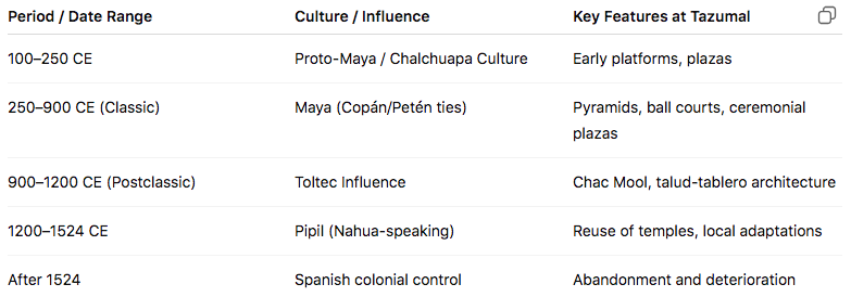
Maybe now it is easier to understand how different groups of people had "built Tazumal" over time. Here is a chart that ChatGPT made for me to summarize the different groups of people who contributed to Tazumal, as well as how they added to and used the site:
Reconstruction
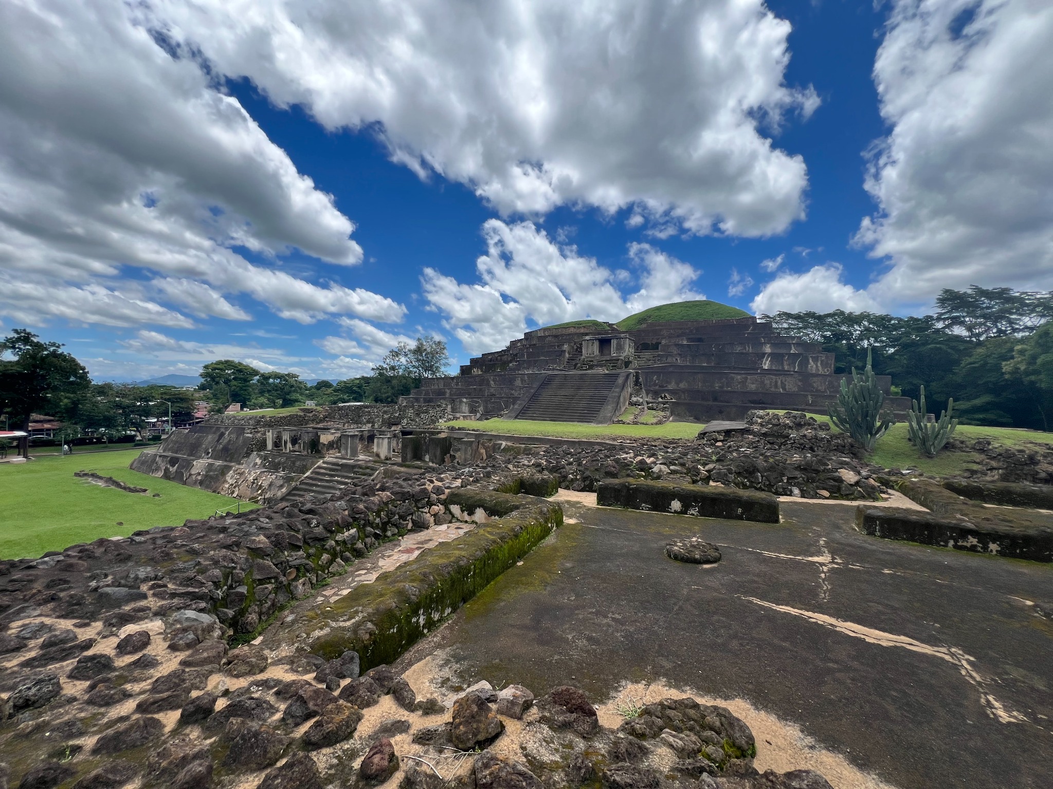
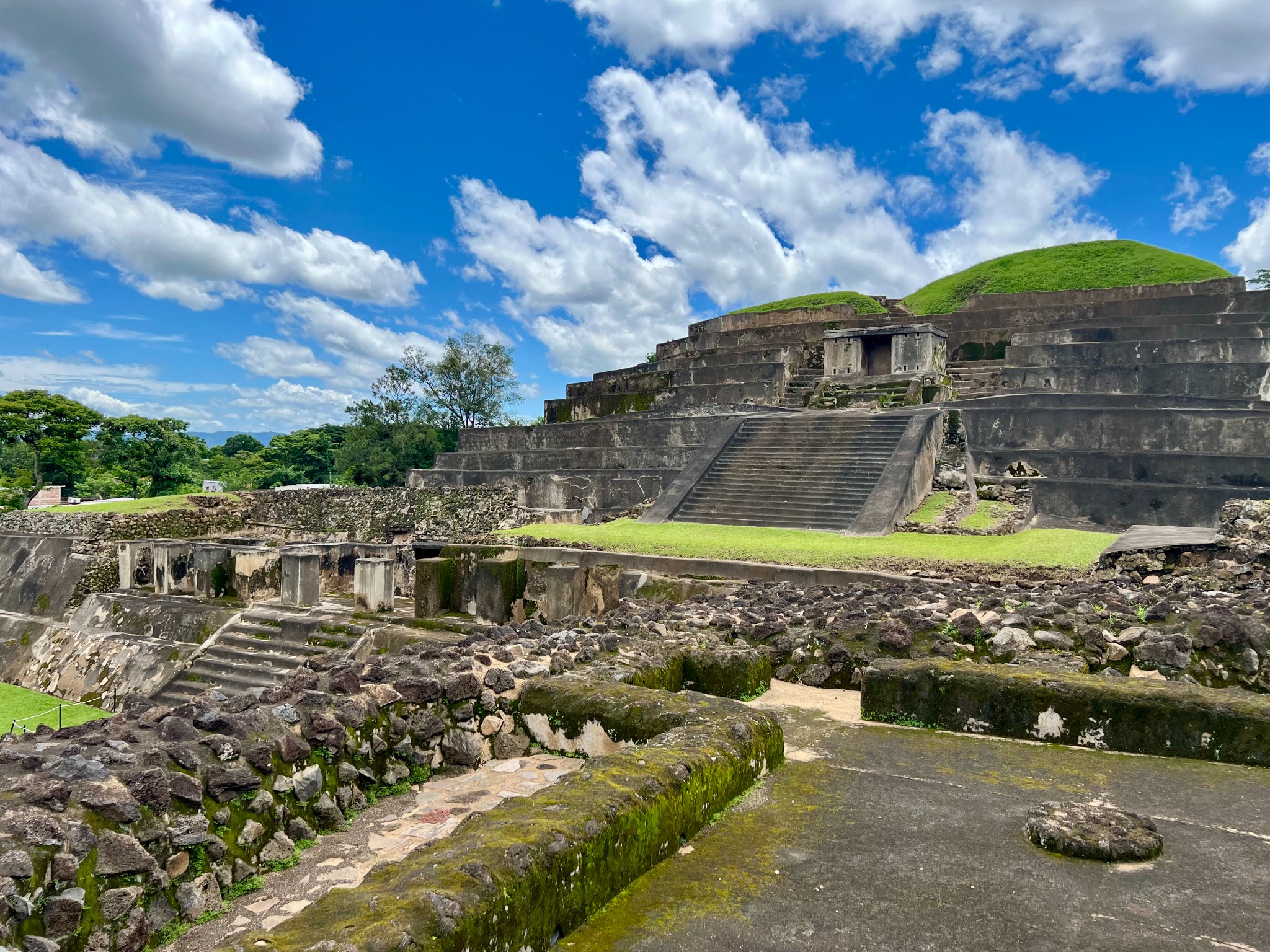
The final contributor to Tazumal was Stanley Boggs, an American archaeologist, who in the 1940's excavated, reimagined, and with a team reconstructed the site. You can see in the chart above how the site deteriorated after the Spanish took colonial control of El Salvador. Of course we wondered how accurate of a portrayal the current vision of the temple is of what it really looked like before its deterioration.
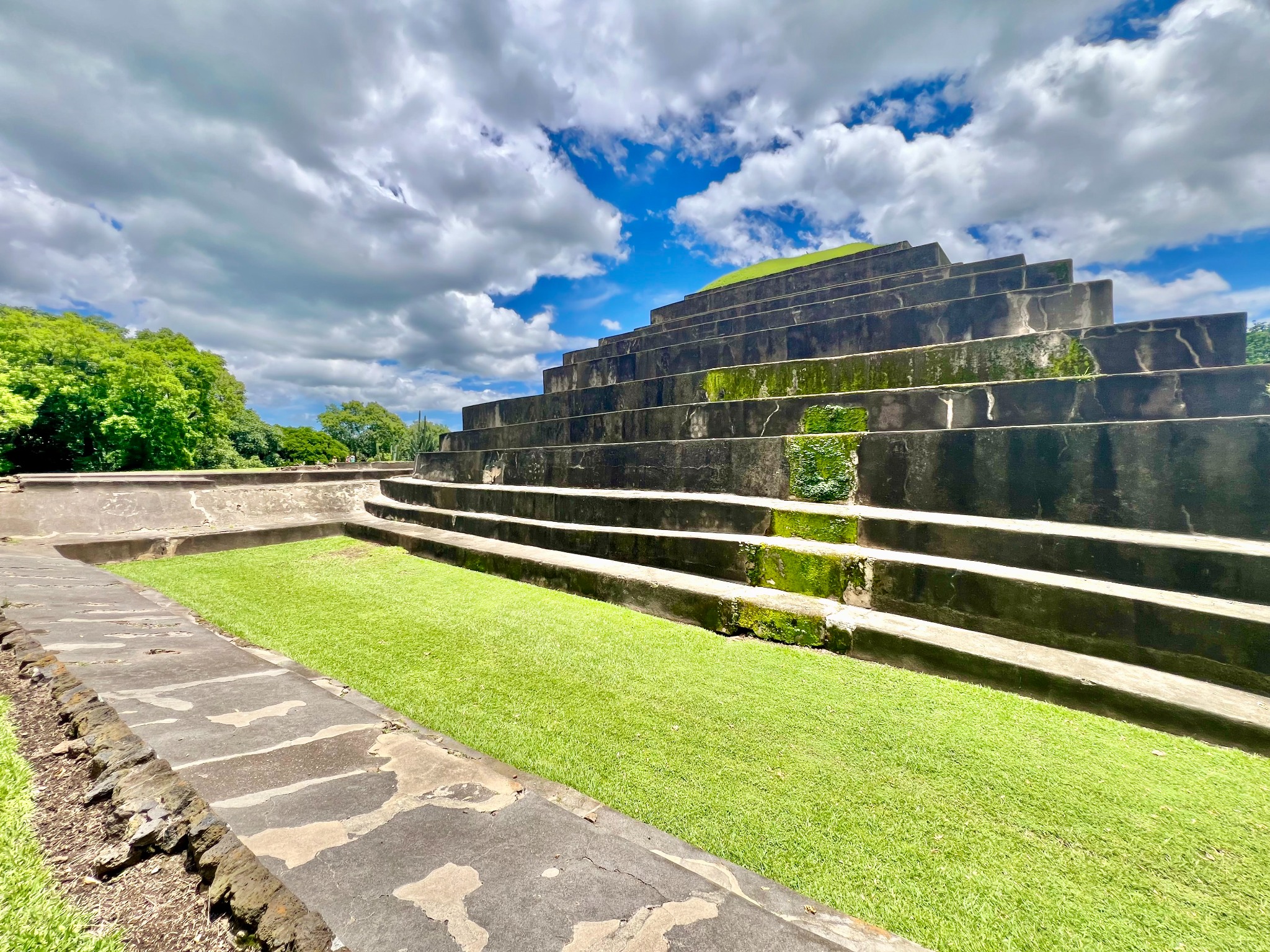
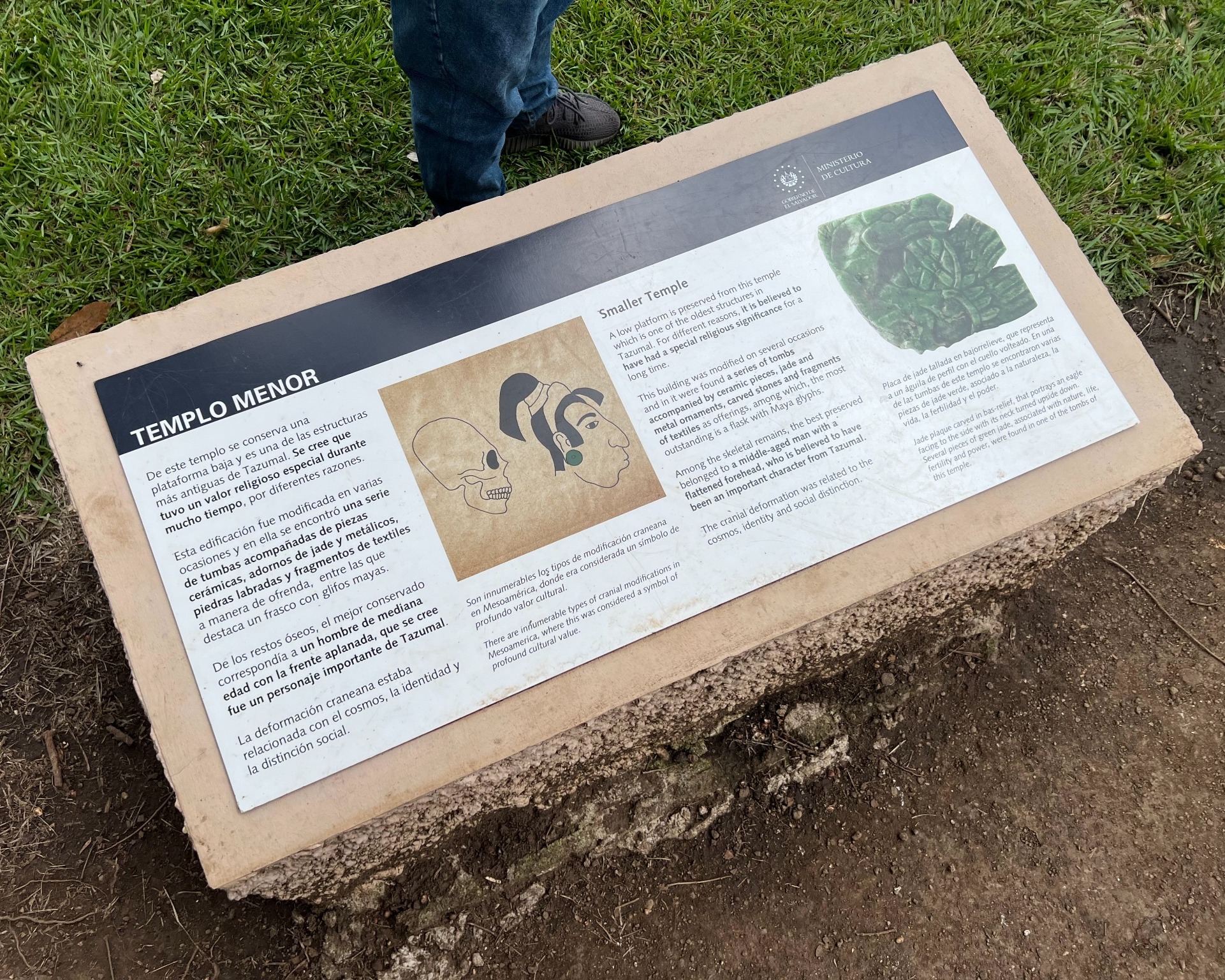
In some of the pictures below you can see the original structures (stones) versus the new construction of Boggs' team (concrete). I'm pretty sure I remember learning that the small portions covered in moss are original portions. Our guide told us that the levels of the upper pyramid were purposely built uneven in order to accommodate water drainage.
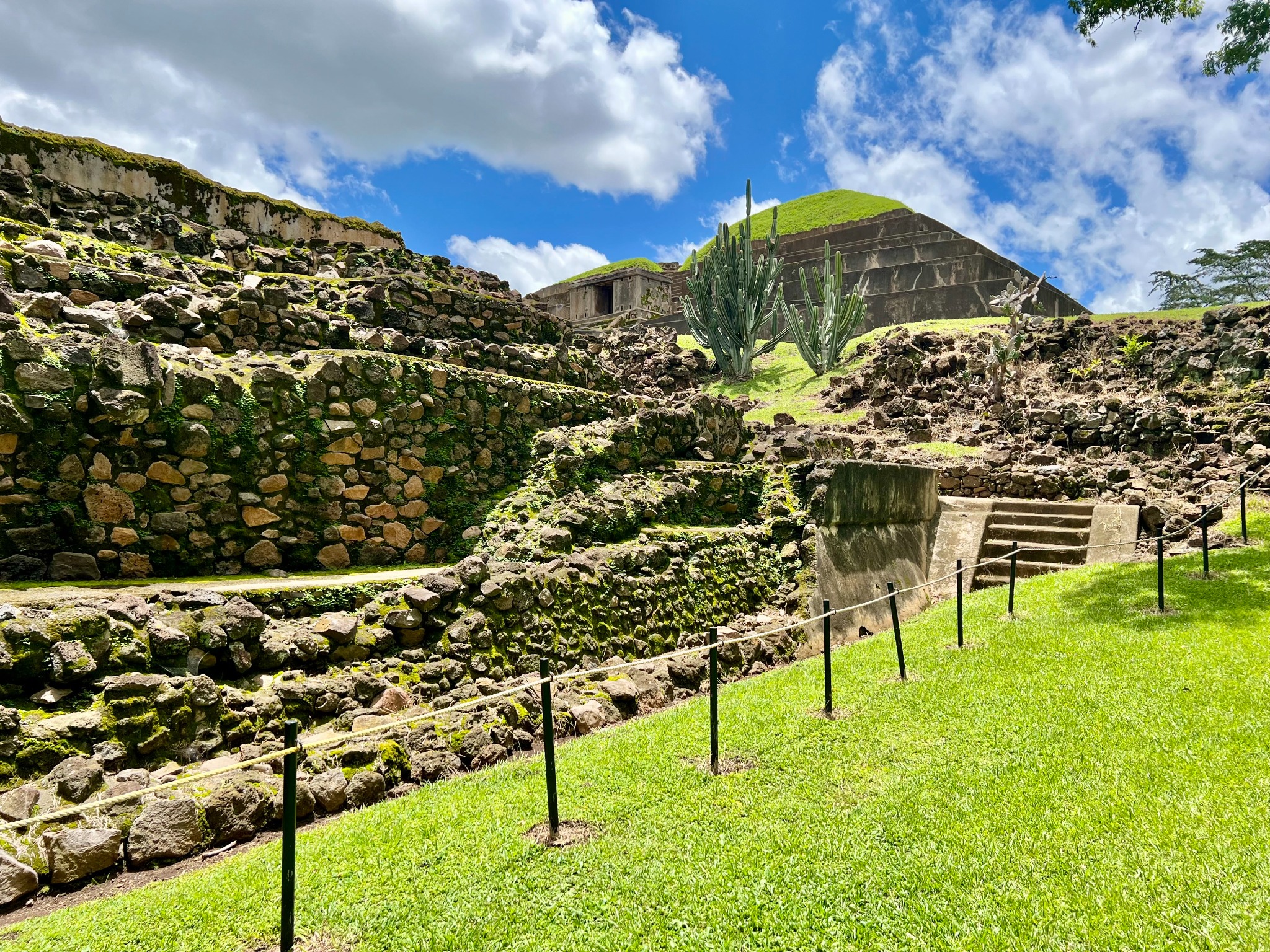
El Salvador is rising
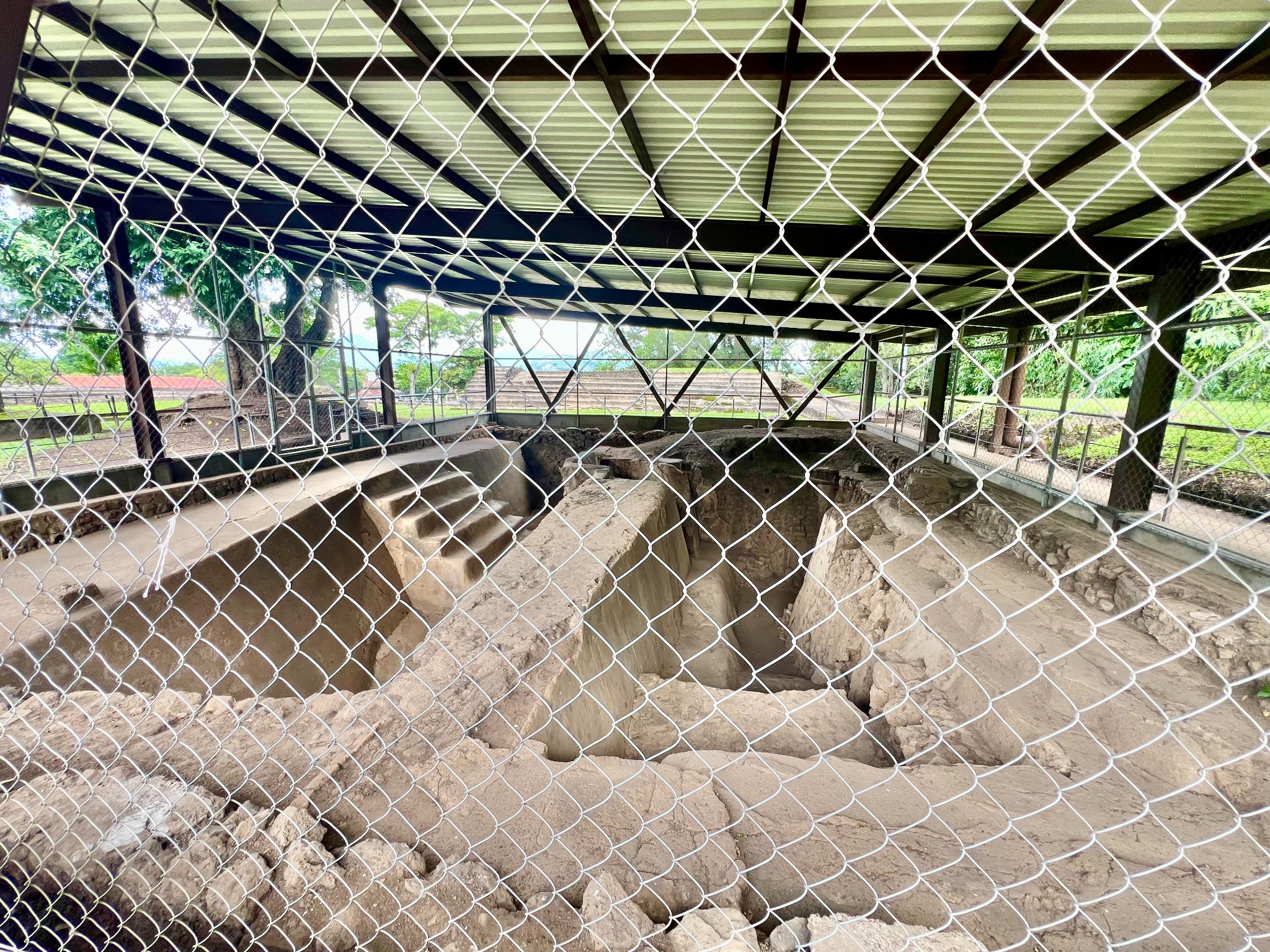
The picture below shows portions of the original site that appear to be underground. But, our guide told us, this structure was initially built at ground level. While many countries in Central America are sinking, he told us, El Salvador is rising, which is why this structure, although it appears to have sunken, has really just been surrounded by the land around it that has risen over thousands of years.
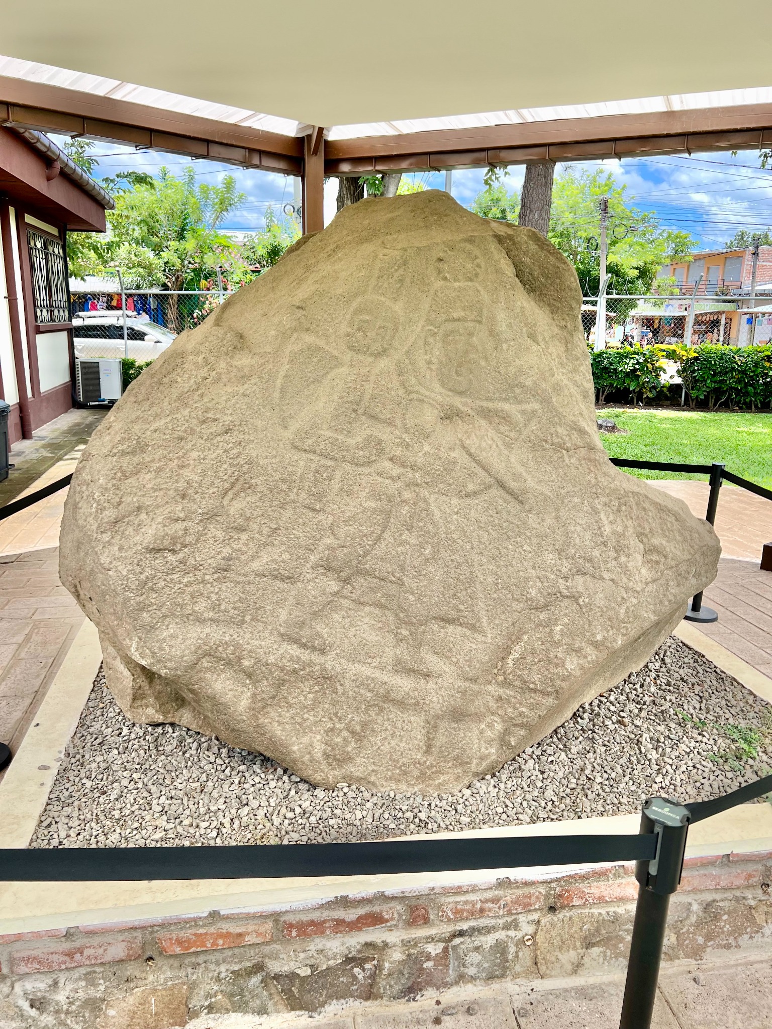
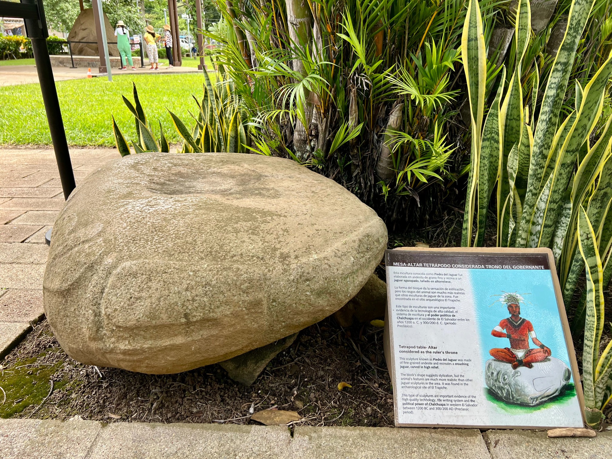
Rock carvings, elongated skulls, and the jaguar stone
A few more pictures with interesting tidbits, and that's all...
Post a comment